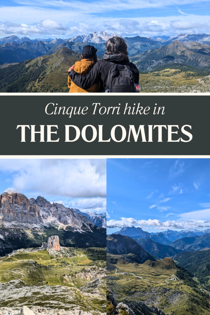
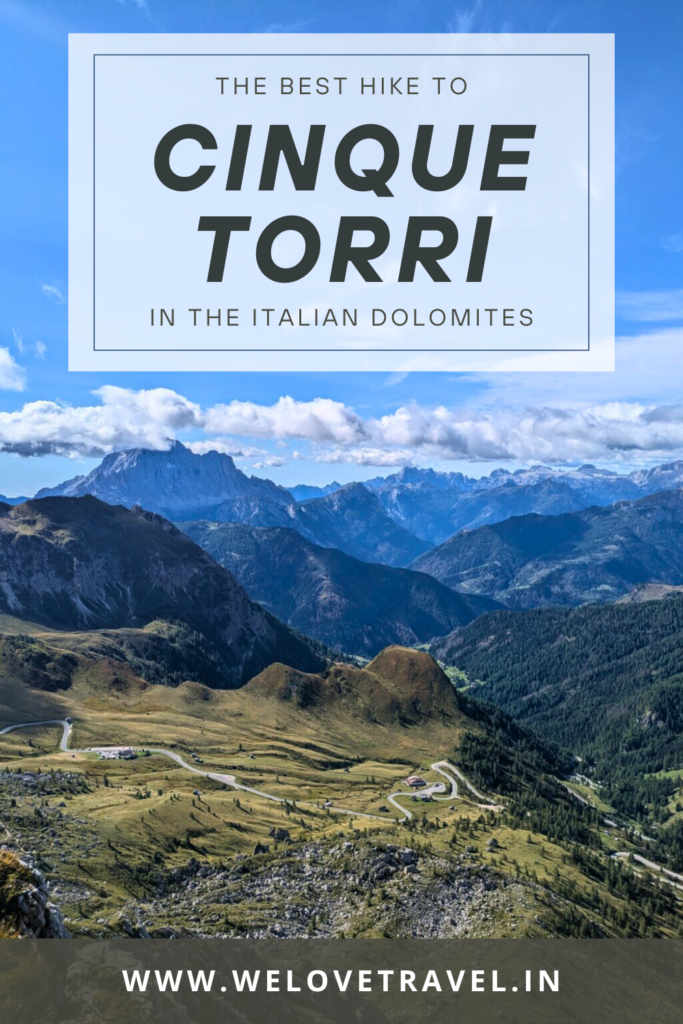
If you’re dreaming of a trip to the Dolomites with adventure, panoramic mountain views and fresh alpine air, then this Cinque Torri hike is an absolute must-do! Nestled in the heart of the Dolomites, this hike takes you to the stunning Rifugio Averau (2,485m) and Rifugio Nuvolau (2,575 m). Both of these mountain huts offer jaw-dropping panoramas, plus food and drink for a well needed recharge!
This guide will take you through everything you need to know for this Cinque Torri hike, and how best to reach Rifugio Averau or Rifugio Nuvolau.
About this hike
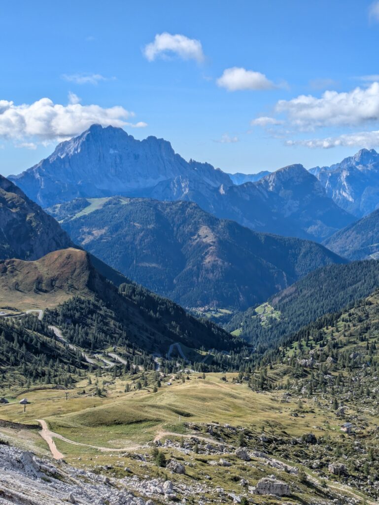
This is one of the most unforgettable hikes in the Dolomites. Along the way, you’ll pass the pretty Lago di Lìmedes, plus Rifugio Averau, Rifugio Nuvolau and the fascinating Cinque Torri towers, littered with WWI history. You’ll also pass Rifugio Scoiattoli and Rifugio 5 Torri, so there’s plenty of opportunity to enjoy some Dolomites delights!
The hike takes you along an anti-clockwise route, firstly to Rifugio Averau, where you then have the option to hike up to Rifugio Nuvolau. The second part of the route takes you to Cinque Torri where you then descend through beautiful alpine forest.
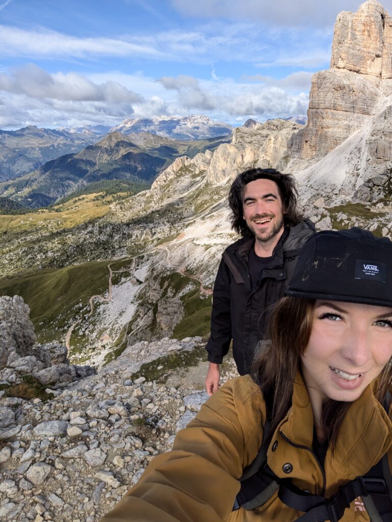
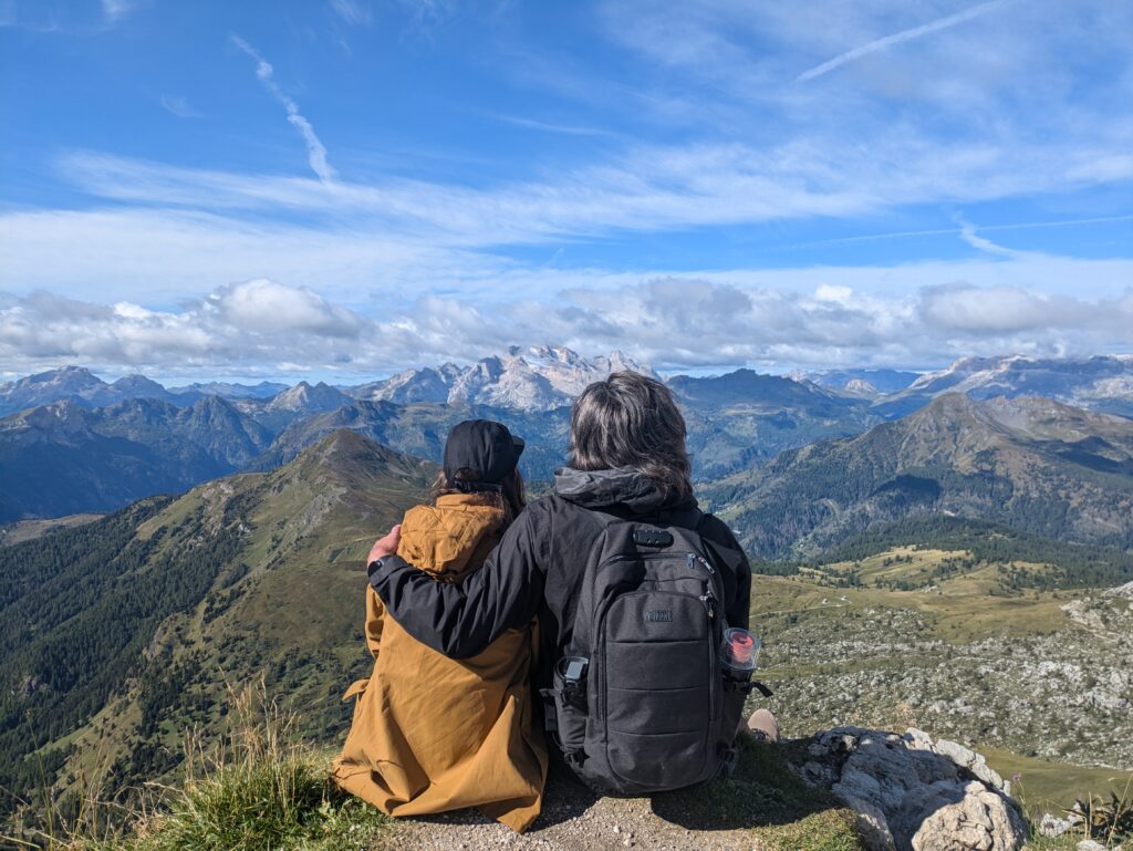
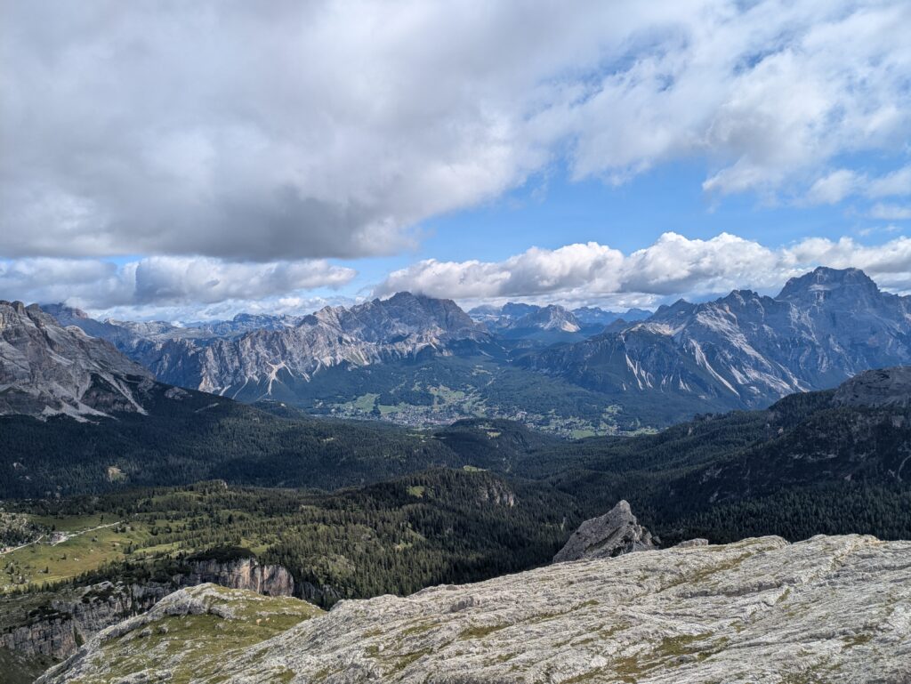
We highly recommend continuing your ascent to Rifugio Nuvolau. Perched on Mount Nuvolau at 2,575 meters (8,500 feet), you’ll be rewarded with 360° views over the Ampezzo valley, with the Cinque Torri group below and across to the Tofane mountains. You’ll also have stunning views of Piz Boè and Marmolada – the highest peak in the Dolomites! There’s no cable car to Nuvolau, so your only option is to hike, but it’s well worth the push. Soaking in these views with a drink and freshly made apple strudel on the Rifugio’s terrace remains one of our favourite Dolomite memories!
Hike Overview
Starting Point: Passo Falzarego, Col Gallina Parking (2,050 m) | Google Maps
Route type: Circular
Distance: 12km (7.5 miles)
Time needed: 3.5 hours
Elevation gain / loss: 735 meters
Difficulty: Moderate
Route: Col Gallina (2,050m) – Lago di Lìmedes (2,171m) – Forcella Averau (2,435m) – Rifugio Averau (2,485m) – Rifugio Nuvolau (2,575m) – Rifugio Scoiattoli (2,255m) – Cinque Torri (2,361m) – Rifugio 5 Torri (2,137m)
Best time to hike: June to October
Parking: We parked for free in the gravel parking area. Alternatively, there’s a car park on the other side of the road outside the restaurant.
Map or GPS?
A quick side note: we personally didn’t bring any hiking maps with us. We found the route on AllTrails, which we downloaded on our phones so we could follow the route offline. Our GPS tracked to the route perfectly. The route is also relatively well sign posted along the way.
Starting the Hike: Col Gallina to Lago di Limedes
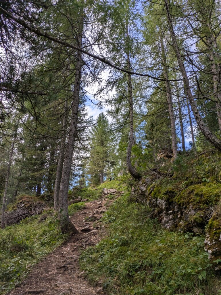
The hike begins at the Col Gallina parking area. The start of the trail can be found at the bottom of the car park, through the picturesque larch forest. Pick up trail 419, in the direction of Rifugio Averau. Along the way, you’ll spot red & white way-points painted on the trees and rocks to help mark the route.
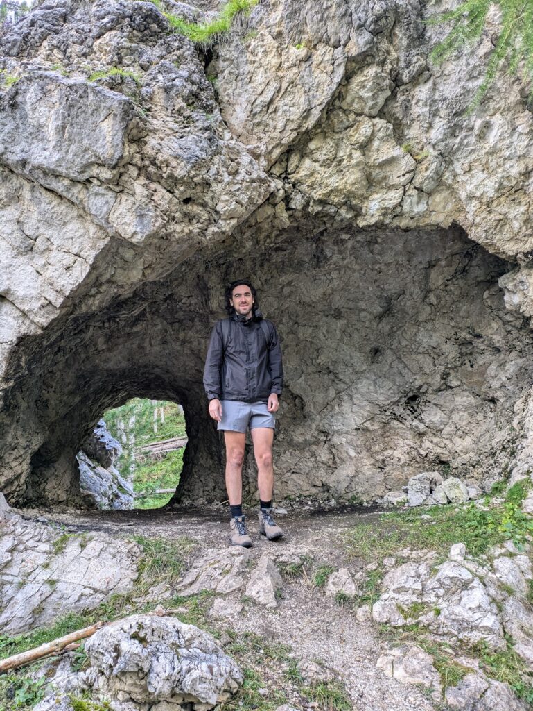
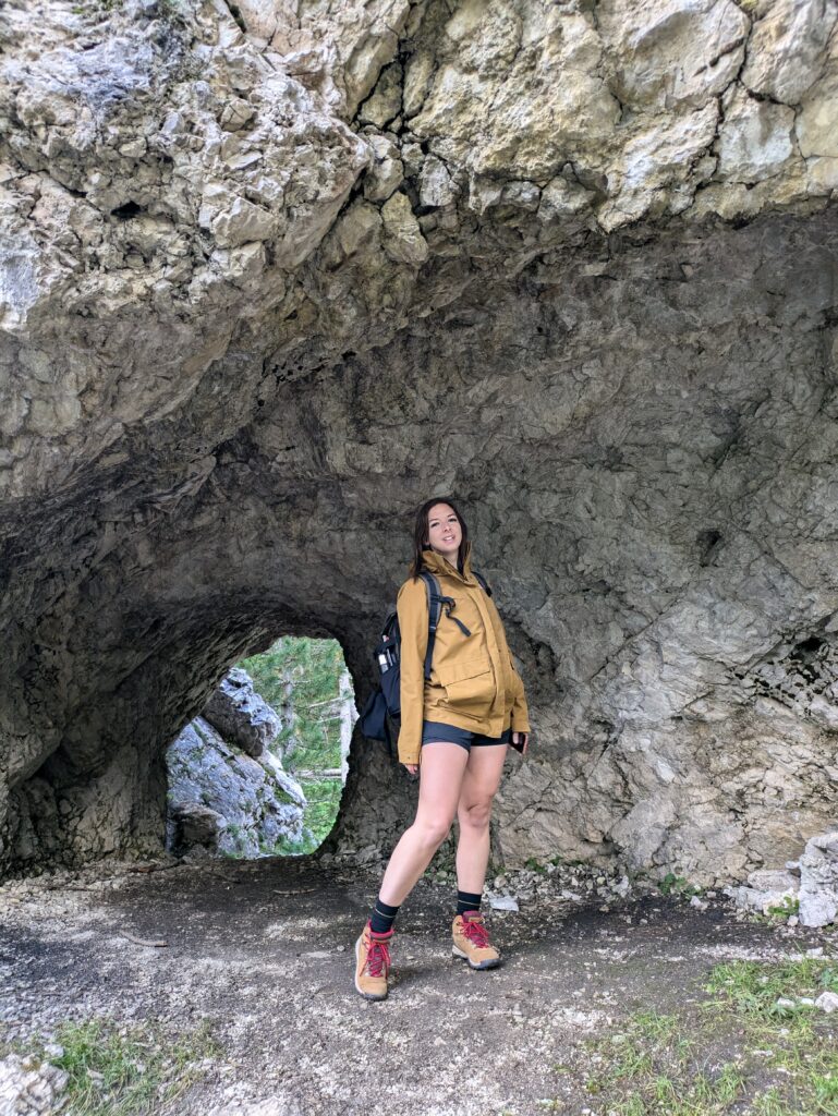
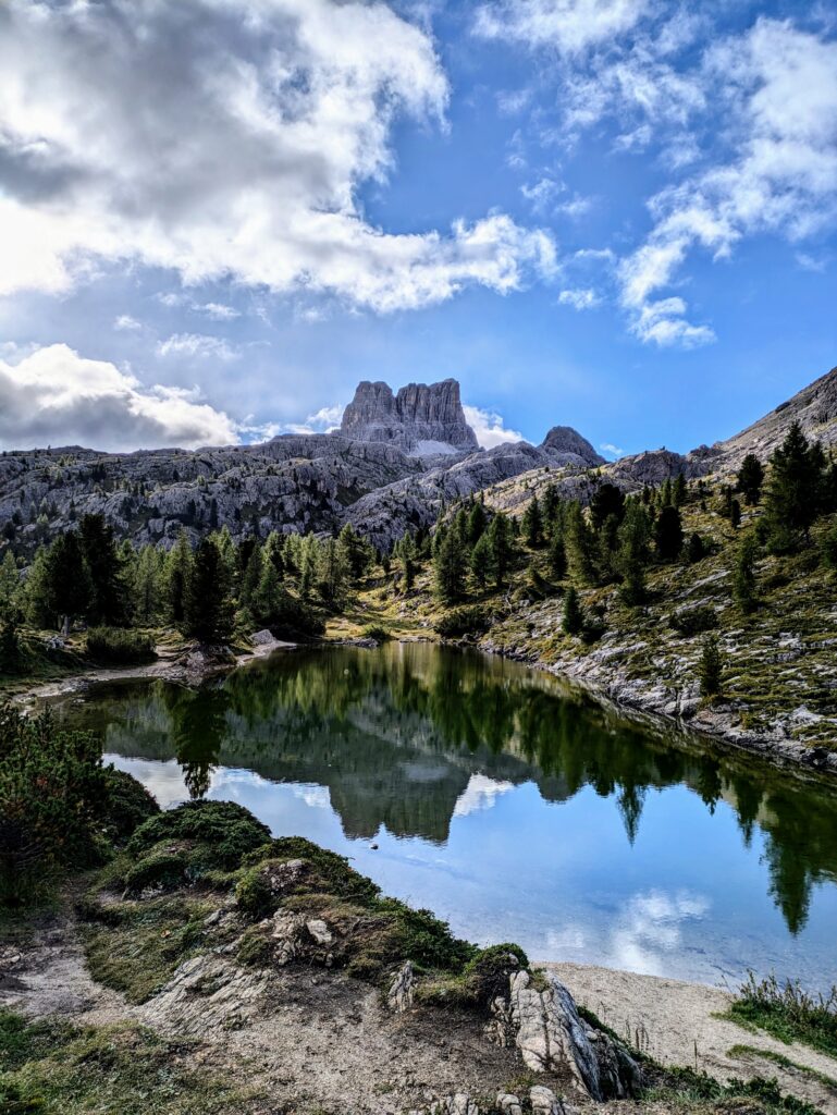
The path is easy to follow and ascends steadily, easing you into the hike. About 5 minutes into the hike you’ll pass a cave, which is fun for an explore and some photos. Continue up the path, and after about 10-15 minutes you’ll leave the treeline behind and cross through a wide meadow. After 1km, you’ll start to head towards Lago di Lìmedes, a picturesque alpine lake that serves as the perfect photo spot, with Monte Averau (the highest mountain of the Nuvolau Group) above you.
Hiking to Rifugio Averau
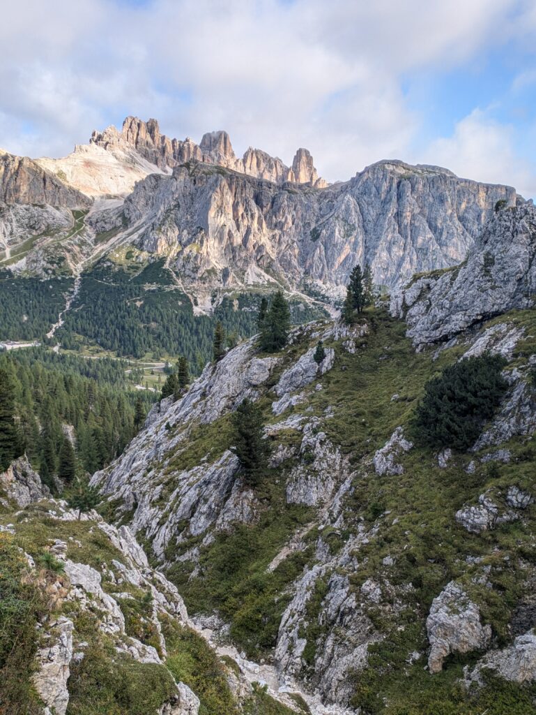
Continuing along trail 419, along the top of the lake, the path becomes more rugged and rocky as you ascend towards Monte Averau. After another 1km, take the opportunity to admire the views behind you of Lagazuoi, Col dei Bos, and Tofana di Rozes. On a clear day you’ll also be able to see Rifugio Lagazuoi perched on the cliff edge.
As the route becomes more uneven and rocky, the path does become more difficult to follow. But as long as you continue to head in the direction of Monte Averau you can’t go too far wrong. Painted red & white way-points continue to mark the route as you go, but some of these are quite faded and are not very obvious. There is another route which also takes you to Monte Averau, which starts on the other side of the lake. However, this is the more interesting route (in our opinion).
While the route is rocky and you may need you hands for some of it, it’s not a technical climb. The ascent however is unrelenting and quite steep at times. Our hearts were definitely pounding! But there are also lots of lovely spots to stop, rest, and catch your breath again. This is definitely one of the most scenic parts of the hike, so it’s worth taking your time a little here, so you can really admire the scenery.
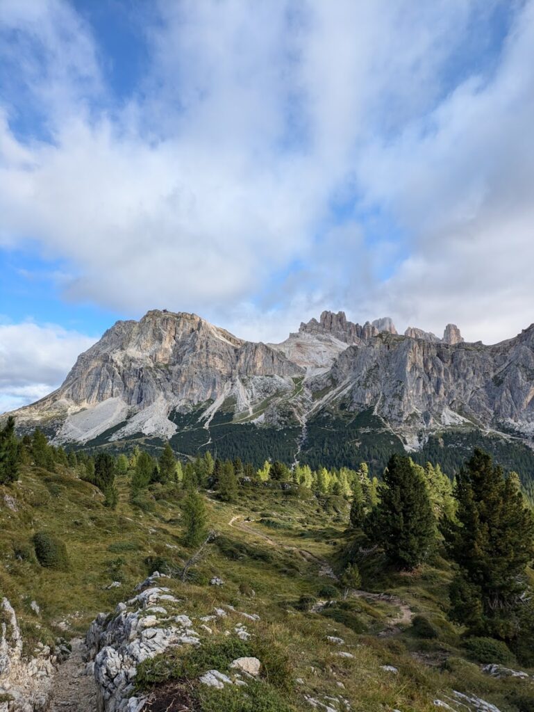
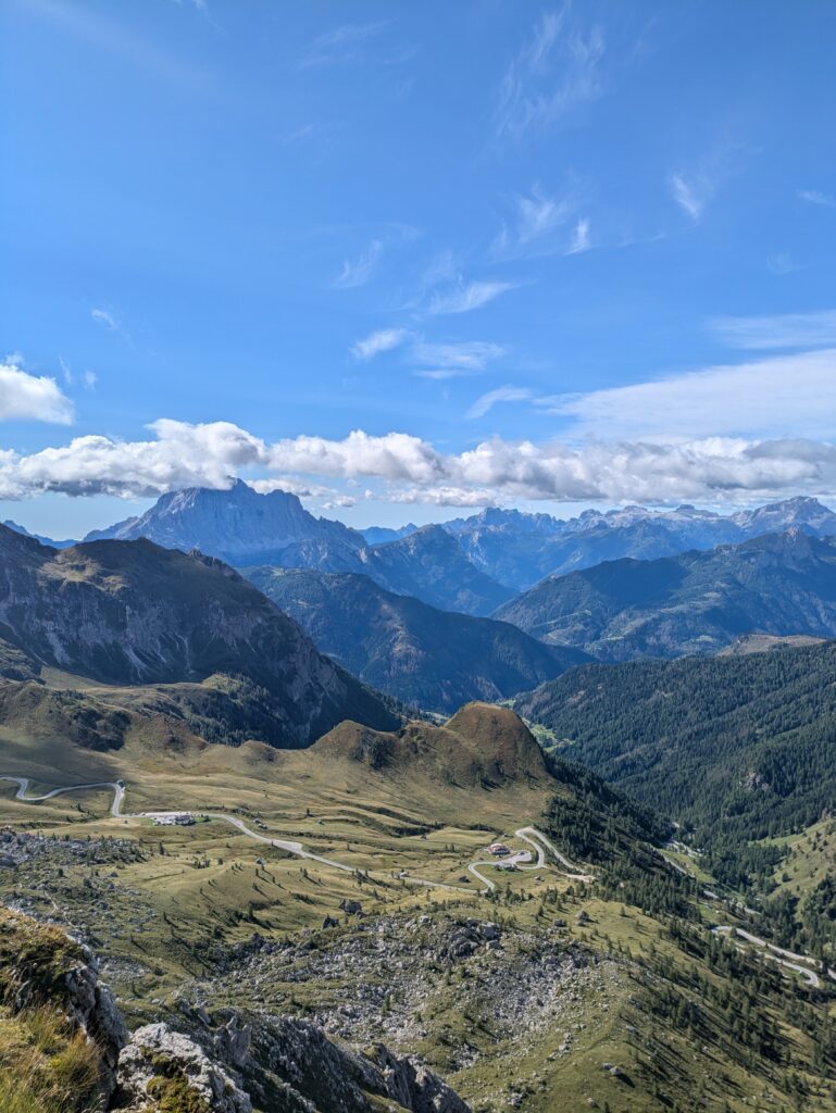
At the top of the pass, just over 3km into your hike, you’ll reach a saddle where trails 419 and 441 merge together. From here, at Forcella Averau, you have the most incredible views of the valley below, Passo di Giau, and the surrounding mountains.
Follow trail 441 which will take you directly to Rifugio Averau. The trail skirts an exposed walkway along Monte Averau. There’s nothing too technical though and it’s wide enough to feel quite comfortable to walk along.
The Route to Rifugio Nuvolau
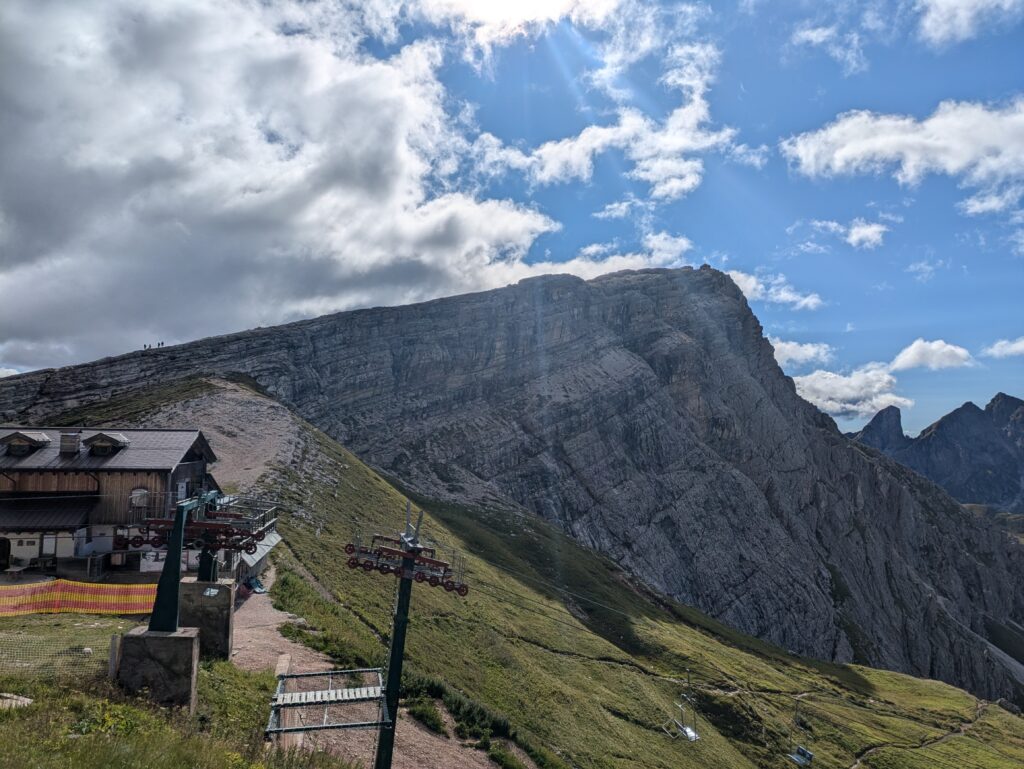
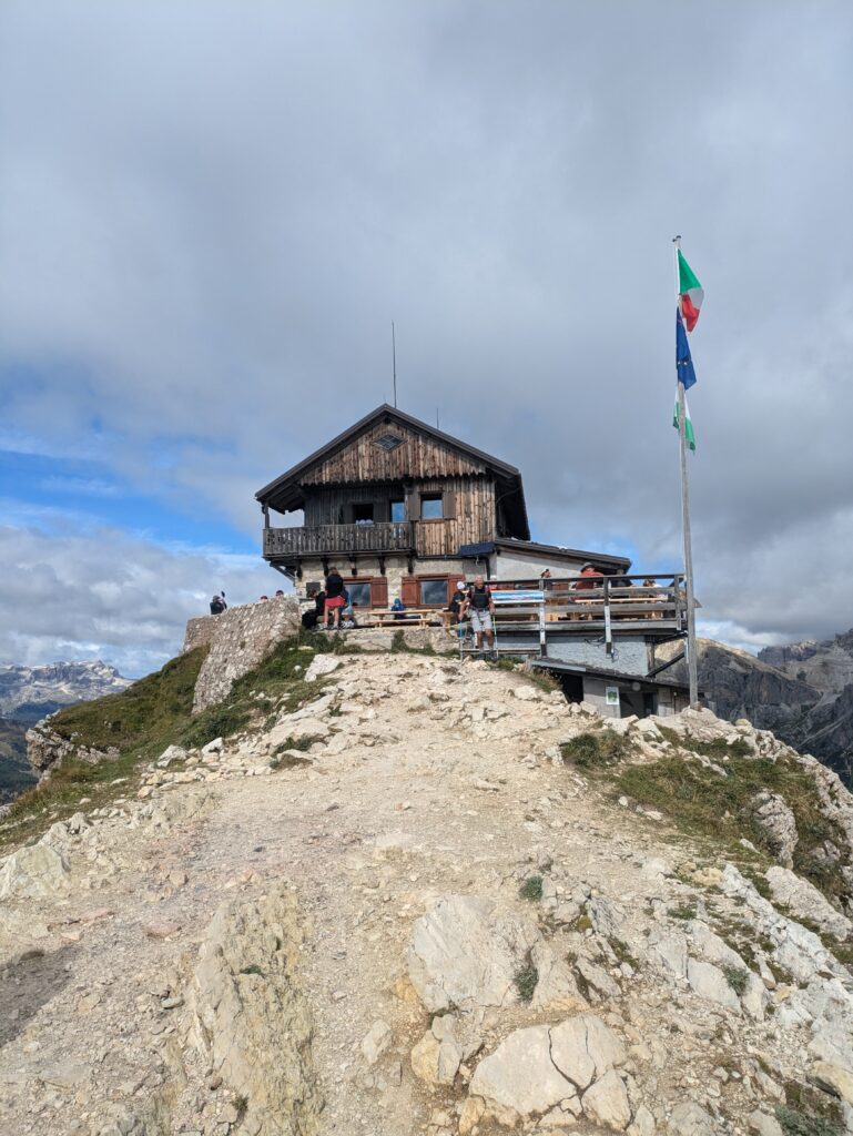
At the end of the walkway on trail 441, just short of 4km into your hike, you’ll reach Rifugio Averau. At this point you’ll also see the imposing slanted ridge of Nuvolau, with the silhouette of Rifugio Nuvolau perched right on the edge! This point is also accessible by ski-lift, so the route may start to feel busier from this point, as this is where day-trippers typically start the hike from.
Rifugio Averau is a cosy mountain hut, with beautiful views. It’s a great place to rest up and recharge. Or, you can head past on your way to Rifugio Nuvolau, along trail 439.
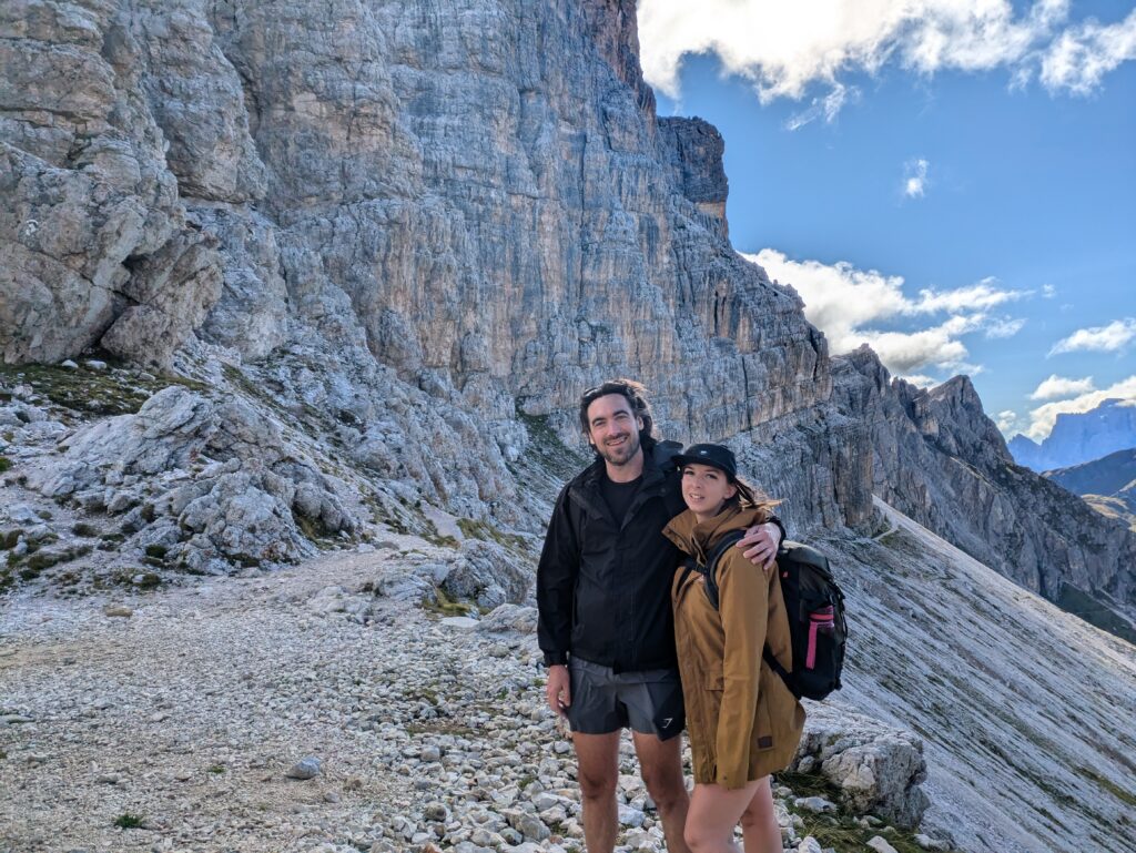
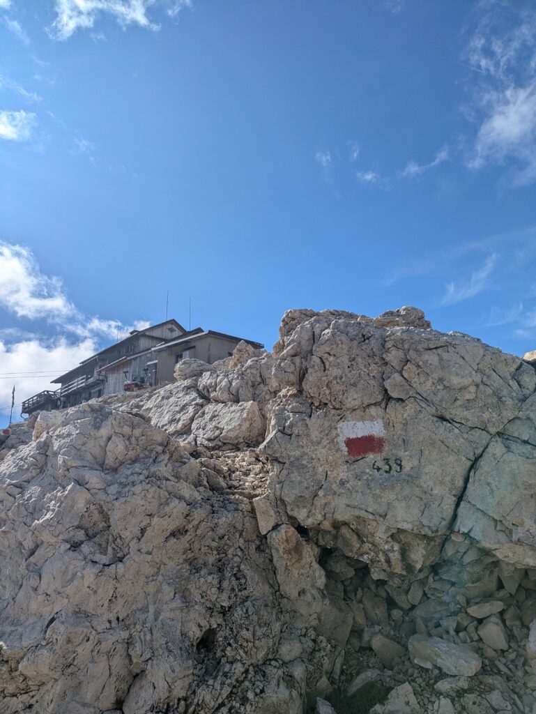
To begin the ascent to Nuvolau, there’s a small scramble to make it onto the ridge. The trail is steep, rocky and very uneven. A big push is needed to complete the final ascent and some careful footing is needed throughout, but the challenge is well worth it! On the way up, we didn’t know which way to look as the most incredible views continued to reveal themselves the higher up we got.
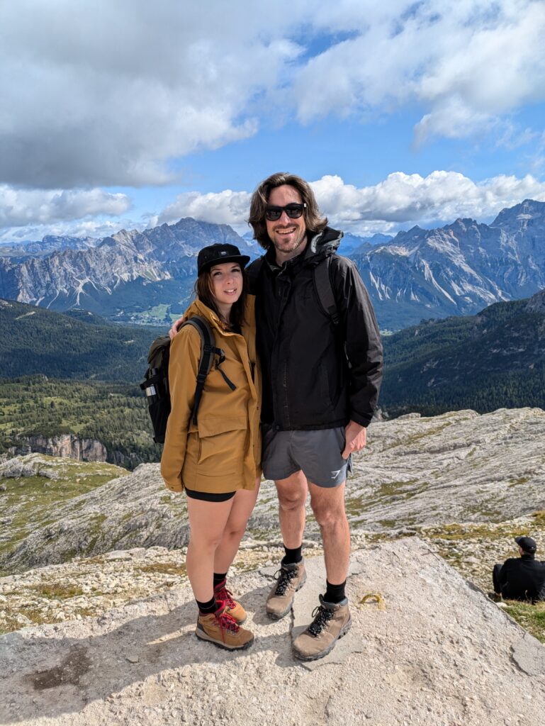
Rifugio Nuvolau
Built in 1883, Rifugio Nuvolau is the oldest Rifugio in the Dolomites! Situated right on the edge of the cliff, once at the top, you will be rewarded with one of most breathtaking panoramas in the Dolomites.
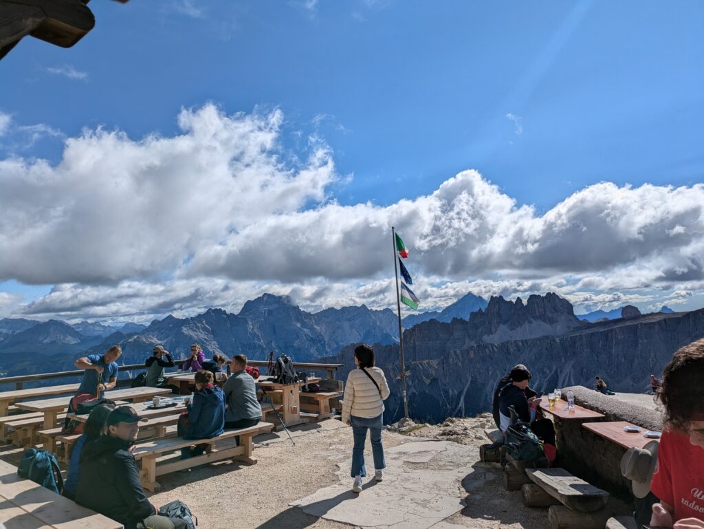
At almost 2,600 meters, you can enjoy the unique experience of sitting outside on the terrace, with a drink and bit of lunch, while you take in the views of the surrounding mountains. We grabbed a table in a nice sunny spot and ordered a coffee, tea, some apple strudel and a cranberry focaccia. The staff here are really nice and speak great English if your Italian or German is not so good. They also accept card payments, and serve beers and spirits too. They also have an outdoor grill if you fancy a hot lunch – unfortunately as vegetarians, there wasn’t anything available for us at the time.
If you’d like to stop off here, we suggest arriving just before lunchtime. We arrived shortly before 11am and it wasn’t too busy, with just a few hikers and small groups. However, as we made our way down (about 11:30am / 12pm) we passed a lot of people on their way up and it was getting noticeably busy.
Hike to Cinque Torri
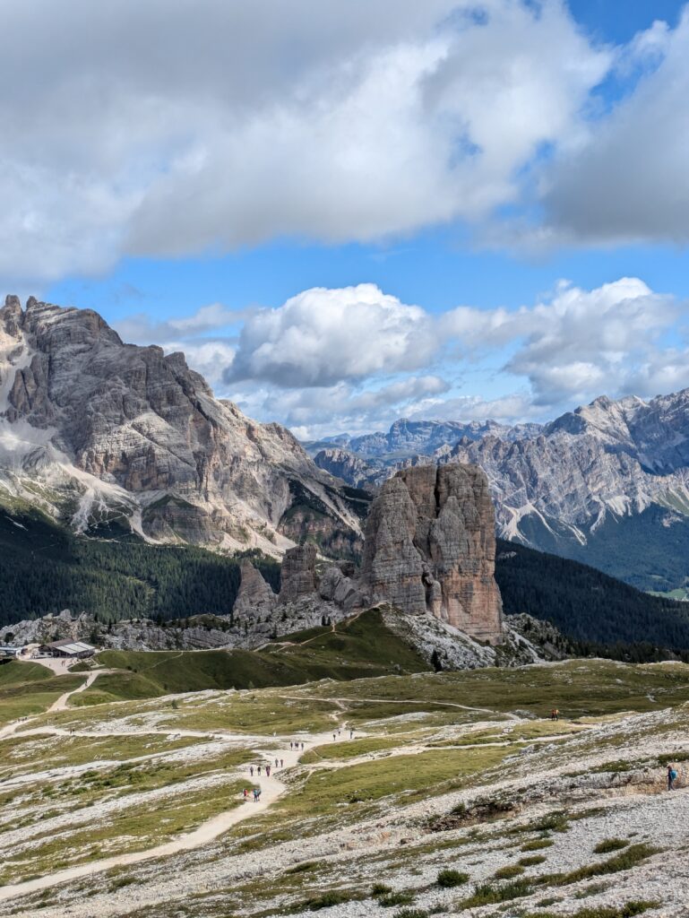
Descend the way you came along 439. Be careful with your footing, as the terrain is rocky and there’s also a lot of scree. Hiking poles might be helpful to save your knees and give a bit more support. Once at the bottom of the slope, the path veers right towards Rifugio Scoiattoli. You will see this and the towers of Cinque Torri on your way down, making it easy to know where you need to go.
Much like Rifugio Averau, there is a ski-lift which takes people directly up to Rifugio Scoiattoli, which is just a short hike to Cinque Torri. As you approach the Rifugio, you will notice large groups of people arriving, particularly if your visit is later in the day. We found however, that most people seemed to hang around the ski-lift to take photos of Cinque Torri from there, rather than head for the towers themselves.
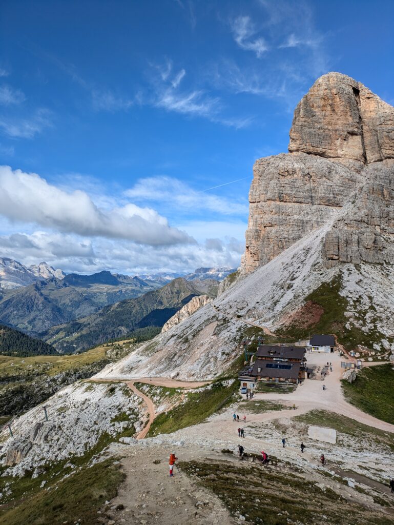
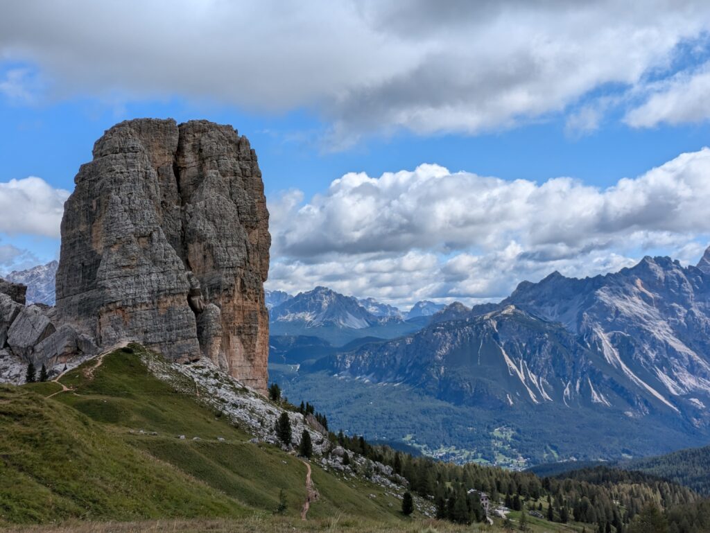
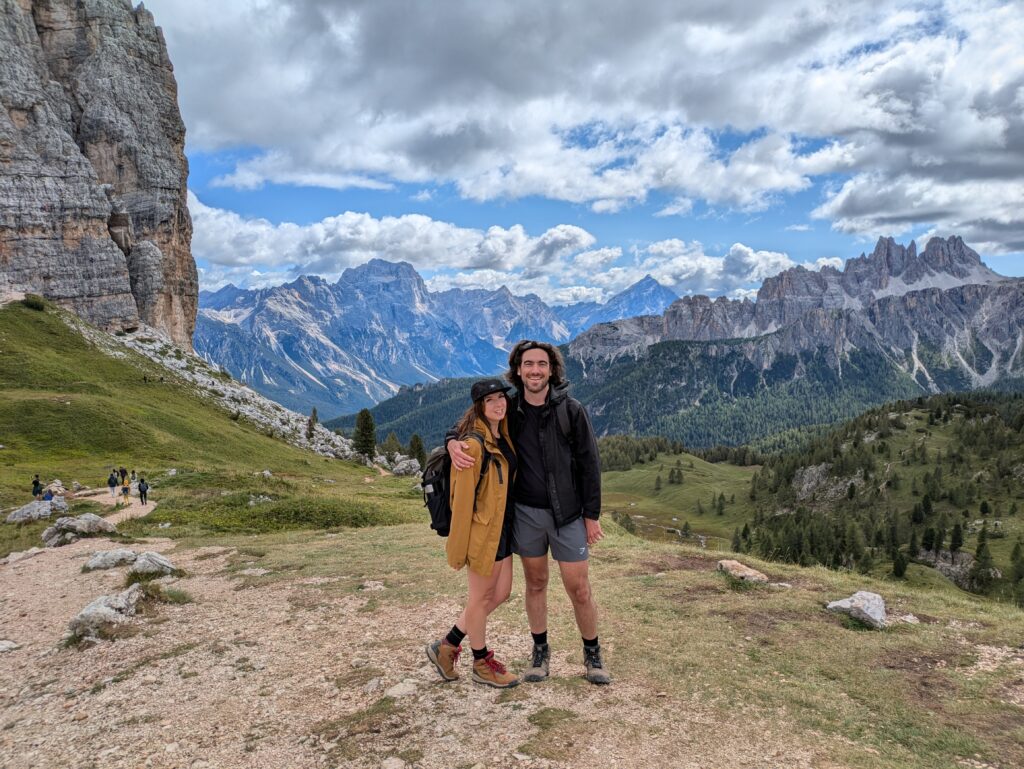
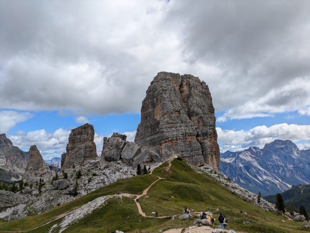
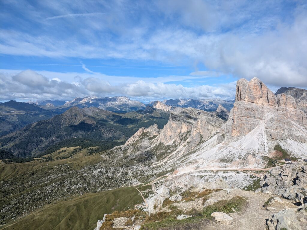
Cinque Torri is a cluster of five unique rock formations. Standing at 2,361m, the area also doubles as an open-air war museum, with various WWI trenches and shelters to explore. Follow the path to the left of the towers. The path will then circle back through the towers so you can begin to make your descent. It’s also interesting to watch a lot of the rock climbers who come to Cinque Torri to climb to the very top. We also saw a couple of free climbers which was very nerve wracking to watch!
By this point you’re about 7km into your hike (so just over half way!). To make your way down, our route heads to the right of the towers towards 5 Torri Rifugio. If you’ve had enough hiking for one day, or don’t fancy the long walk back (who likes the descent part of a hike anyway??) then you can grab the ski-lift to the bottom of the mountain. It’s then just a short walk back to the car park where you started.
The Way Back Down
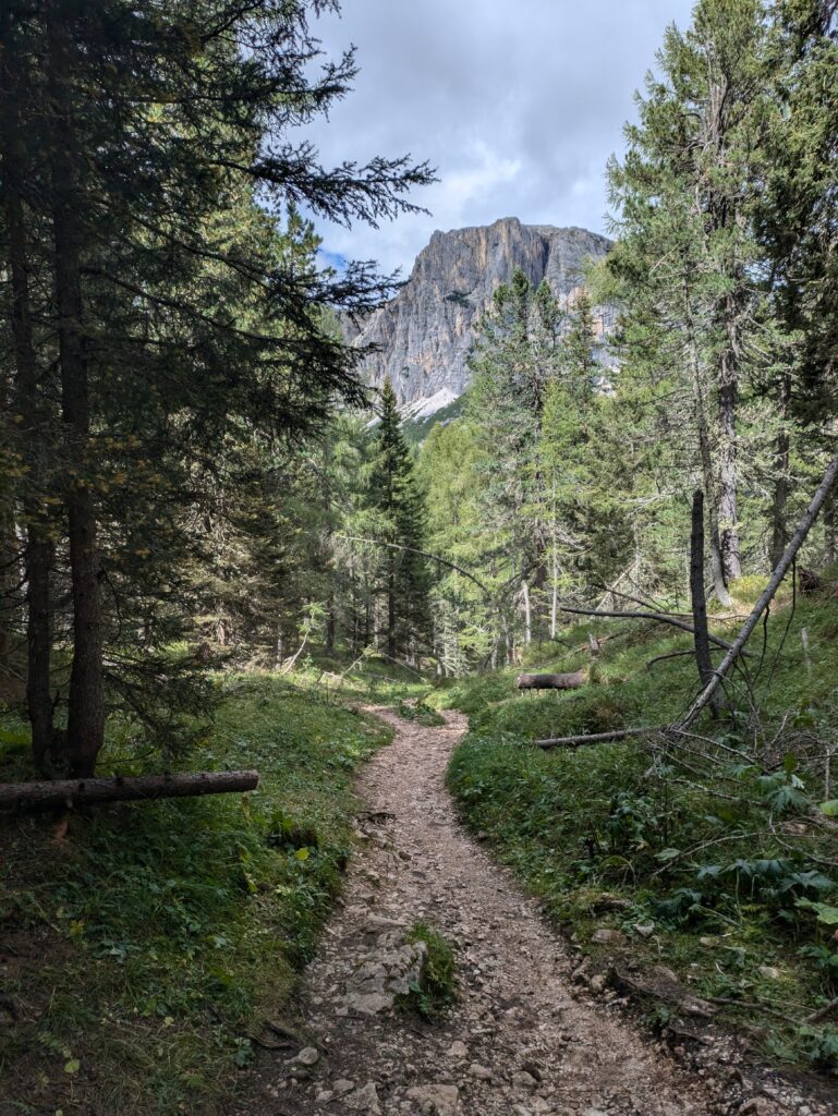
We’ll be up front. The route back to the car park was not fun! The trail starts off fine, down a gravel path, with switchbacks to 5 Torri Rifugio. You then follow a tarmac road all the way down, back through the forest. The route is easy on the knees and very picturesque through the woods. The route eventually leads you to the bottom of the ski-lift (the one that takes you up to Cinque Torri). Walking to this point marks roughly 10km, and by this point we were feeling pretty tired and thought the car park where we started was closer than it really was.
However, the part we didn’t enjoy about the hike is that it cuts across the ski-lift car park and back into the forest. This part of the route is very muddy and boggy if there has been recent rainfall. The path also undulates a lot, with some surprisingly steep inclines. Our legs were feeling particularly tired by this point and dealing with more inclines felt like hard work!
If you want a big Cinque Torri hike, then by all means this is a great route. It’s challenging and tiring, but you will really feel like you’ve really accomplished something at the end of it. Even if you do feel exhausted! However, there are a couple of alternatives routes, which we’ve included below.
Alternative Routes to Rifugio Averau & Rifugio Nuvolau
If you’re looking for a shorter hike, or just want to experience the views without the effort of a fall day’s trek, we suggest taking one of the ski-lifts:
#1 Ski-lift to Rifugio Averau
From Passo Giau, take the ski-lift from Rifugio Fedare to Rifugio Averau. From here you can hike the 1km route up to Nuvolau. The lift typically runs from June to October. If you’re travelling before or around this time, it’s always worth double checking dates before your visit. After your hike to Nuvolau, you then grab the lift back down.
Distance: 2km out-and-back Difficulty: Easy / moderate Elevation: c. 180 meters Duration: 1 hour (there and back, not including stopping time at the Rifugio)
#2 Ski-lift to Rifugio Scoiattoli
Park at Baita Bai de Dones and grab the ski-lift up to Rifugio Scoiattoli. From here, you can hike Cinque Torri and explore the impressive towers. Followed by a short hike straight up to Rifugio Averau and Rifugio Nuvolau. On the way back down, you can either catch the ski-lift again, or choose to hike the alternative route highlighted below.
Distance: 6km out-and-back (assuming Cinque Torri – Averau – Nuvolau) Difficulty: Easy / moderate (depending if you tag on Nuvolau or not) Elevation: c. 300 meters Duration: 3 hours (there and back, not including stopping time at the Rifugio)
Alternative Route from Cinque Torri
To avoid the 5km hike down the way that we came (explained above), you can also take trail 440 to the Monte de Potor trail junction. From here, follow the route all the way down to Baita Bai de Dones ski-lift. If you’ve completed the rest of the hike, and therefore parked at Col Gallina, you will need to continue left, through the woods along trail 424. This remains the part of the hike that we enjoyed the least. So unfortunately if you’ve parked at Col Gallina, there’s no way to avoid this part of the hike back.
Tips for your Rifugio Nuvolau / Cinque Torri Hike
Timing: Aim to start early in the morning to reach Rifugio Nuvolau no later than lunchtime. This way, you’ll beat the crowds and enjoy a more peaceful experience.
Facilities: There are toilets at Rifugio Scoiattoli, Rifugio Averau, and Rifugio Nuvolau. All three also offer food and drink, and accept card payments.
Parking: Free parking is available at Col Gallina.
Weather: The best time for hiking is from June to October. However always check the weather forecast the day before and on the day, before venturing up. We visited in early September and had lovely hot sunshine. Two days later the rifugio’s were covered in snow! We recommend 3B Meteo as a good weather app.
What to pack: You need good hiking boots with good ankle support. Bring plenty of water and some snacks for the hike. It’s a good idea to wear a base layer, with either a jumper or light rain jacket over the top. Pack whichever one you don’t wear inside your bag. It can get quite cold at the summit and an extra layer will come in handy!
Trail map / GPS: A lot of people use Tabaco Maps for getting around the Dolomites. For this hike, we downloaded our route to be offline from AllTrails and we found this worked perfectly.
Get in touch
Whether you’re an experienced hiker or someone just looking for an unforgettable day in the Dolomites, the Cinque Torri Hike to Rifugio Averau and Rifugio Nuvolau promises breathtaking views and memorable experiences! This was one of the highlights of our trip!
We hope you found this guide helpful. If you have any questions please leave a comment below, we’d love to hear from you! If you found our blog helpful, check out our Insta @welovetravel.in – if you give us a follow feel free to drop us a message and say hello 👋
Interested to see where else we’ve adventured to? Check out our Travel Bucket List below 👇
If you found our blog helpful, check out our Insta @welovetravel.in and if you give us a follow don’t forget to say hey! ✌️For more travel inspiration, fun things to do, and travel guides, check out our other posts below: